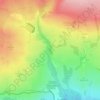
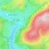
Crambe topographic map
Click on the map to display elevation.
Crambe
The village is at an elevation of 160 feet (49 m) above sea level, lies 0.6 miles (0.97 km) from the A64 road and within a bend in the River Derwent, Yorkshire. The nearest settlements to Crambe are Kirkham 0.5 miles (0.8 km) to the north-east; Whitwell-on-the-Hill 0.9 miles (1.4 km) to the north-west; Barton Hill 1.6 miles (2.6 km) to the south-west and Howsham 1.43 miles (2.30 km) to the south. It is also near Kirkham Priory, Howsham Hall, and Castle Howard.
About this map

Name: Crambe topographic map, elevation, terrain.
Average elevation: 36 m
Minimum elevation: 9 m
Maximum elevation: 93 m
North Yorkshire trails, hiking, mountain biking, running and outdoor activities
Other topographic maps
Click on a map to view its topography, its elevation and its terrain.









Bolton Castle
United Kingdom > England > North Yorkshire > Redmire > Castle Bolton
Average elevation: 250 m
Thimbleby & Osmotherly Show field
United Kingdom > England > North Yorkshire > Thimbleby
Average elevation: 152 m




Killinghall
United Kingdom > England > North Yorkshire > Harrogate > Killinghall
Average elevation: 86 m



Ribblesdale
United Kingdom > England > North Yorkshire > Horton in Ribblesdale
Average elevation: 368 m
Willerby Brow Plantation
United Kingdom > England > North Yorkshire > Ryedale > Staxton > Binnington
Average elevation: 100 m

Howgill
United Kingdom > England > North Yorkshire > Craven > Appletreewick > Howgill
Average elevation: 257 m