Geolocate

Ocean Springs topographic map

Click on the map to display elevation.

About this map
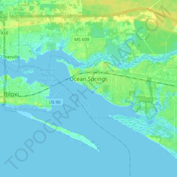
Name: Ocean Springs topographic map, elevation, terrain.

Location: Ocean Springs, Jackson County, Mississippi, 39564, United States (30.38116 -88.85995 30.45835 -88.70865)

Average elevation: 6 m

Minimum elevation: -3 m

Maximum elevation: 18 m

Other topographic maps

Click on a map to view its topography, its elevation and its terrain.
Harleston

United States > Mississippi > Jackson County

Average elevation: 36 m

Gear up for your next adventure:

👟Waterproof Leg Gaiters - Keep mud and water out of your boots in boggy terrain
📱Phone Mounts for Hiking - Secure mounts to carry your phone on trails
☕Insulated Travel Mugs - Keep drinks hot while surveying the landscape from a summit
🎒Hiking Daypacks - Compact backpacks ideal for short hikes and excursions
🥾Men's Waterproof Hiking Boots - Durable footwear with deep lugs for muddy and rocky UK terrains

As an Amazon Associate, this site earns from qualifying purchases at no extra cost to you.