
Mount Steele topographic map
Interactive map
Click on the map to display elevation.
About this map
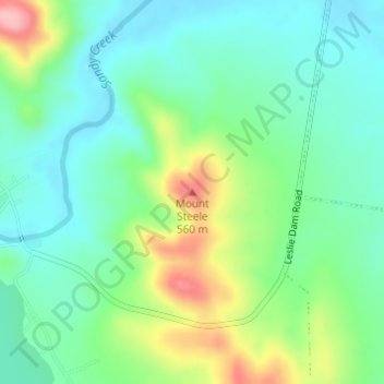
Name: Mount Steele topographic map, elevation, terrain.
Location: Mount Steele, Warwick, Queensland, 4370, Australie (-28.21422 151.93467 -28.21412 151.93477)
Average elevation: 486 m
Minimum elevation: 442 m
Maximum elevation: 585 m
Other topographic maps
Click on a map to view its topography, its elevation and its terrain.
The Falls
Australie > Queensland > Warwick
The Falls, Warwick, Queensland, 4370, Australie
Average elevation: 952 m