
Daimiel topographic map
Interactive map
Click on the map to display elevation.
About this map
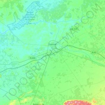
Name: Daimiel topographic map, elevation, terrain.
Average elevation: 633 m
Minimum elevation: 601 m
Maximum elevation: 785 m
Other topographic maps
Click on a map to view its topography, its elevation and its terrain.
La Solana
Espagne > Castille-La Manche > La Mancha
La Solana, La Mancha, Ciudad Real, Castille-La Manche, Espagne
Average elevation: 736 m