
La Solana topographic map
Interactive map
Click on the map to display elevation.
About this map
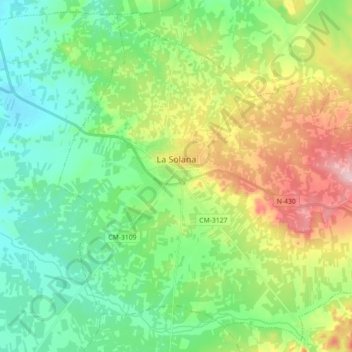
Name: La Solana topographic map, elevation, terrain.
Location: La Solana, La Mancha, Ciudad Real, Castille-La Manche, Espagne (38.87042 -3.29620 38.99962 -3.11808)
Average elevation: 736 m
Minimum elevation: 672 m
Maximum elevation: 869 m
Other topographic maps
Click on a map to view its topography, its elevation and its terrain.
Daimiel
Espagne > Castille-La Manche > La Mancha
Daimiel, La Mancha, Ciudad Real, Castille-La Manche, 13250, Espagne
Average elevation: 633 m