
Thank you for supporting this site ❤️
Make a donation
Make a donation
Gear up for your next adventure:
As an Amazon Associate, this site earns from qualifying purchases at no extra cost to you.
Fuzuli topographic map
Click on the map to display elevation.
Thank you for supporting this site ❤️
Make a donation
Make a donation
Gear up for your next adventure:
As an Amazon Associate, this site earns from qualifying purchases at no extra cost to you.
About this map
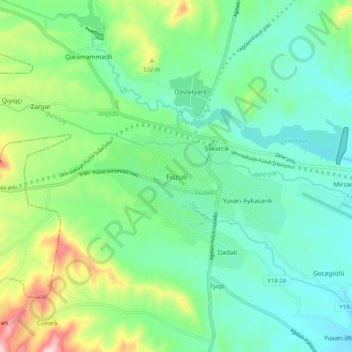
Name: Fuzuli topographic map, elevation, terrain.
Location: Fuzuli, Fizuli District, Karabakh, Azerbaijan (39.56074 47.10857 39.64074 47.18857)
Average elevation: 430 m
Minimum elevation: 339 m
Maximum elevation: 680 m
Thank you for supporting this site ❤️
Make a donation
Make a donation
Gear up for your next adventure:
As an Amazon Associate, this site earns from qualifying purchases at no extra cost to you.
Other topographic maps
Click on a map to view its topography, its elevation and its terrain.
Khankendi
Stepanakert is located on the Karabakh plateau, at an average altitude of 813 m (2,667 ft) above sea level.
Average elevation: 862 m