
Aghdam topographic map
Interactive map
Click on the map to display elevation.
About this map
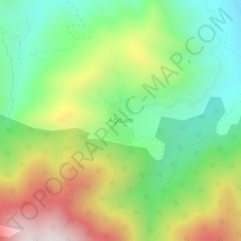
Name: Aghdam topographic map, elevation, terrain.
Location: Aghdam, Khojavend District, Karabakh, Azerbaijan (39.55240 46.94915 39.55763 46.95311)
Average elevation: 1,126 m
Minimum elevation: 798 m
Maximum elevation: 1,631 m
Other topographic maps
Click on a map to view its topography, its elevation and its terrain.