
Estorãos topographic map
Interactive map
Click on the map to display elevation.
About this map
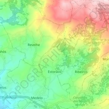
Name: Estorãos topographic map, elevation, terrain.
Location: Estorãos, Fafe, Braga, Portugal (41.45871 -8.15430 41.50500 -8.11642)
Average elevation: 441 m
Minimum elevation: 282 m
Maximum elevation: 694 m
Other topographic maps
Click on a map to view its topography, its elevation and its terrain.