
Miyoshi topographic map
Interactive map
Click on the map to display elevation.
About this map
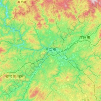
Name: Miyoshi topographic map, elevation, terrain.
Location: Miyoshi, Hiroshima Prefecture, 728-0011, Japan (34.60522 132.63336 35.00460 133.10966)
Average elevation: 386 m
Minimum elevation: 67 m
Maximum elevation: 1,180 m