
Schaan topographic map
Interactive map
Click on the map to display elevation.
About this map
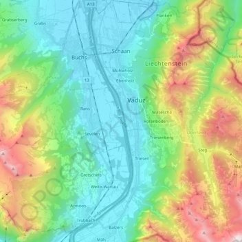
Name: Schaan topographic map, elevation, terrain.
Location: Schaan, Oberland, 9494, Liechtenstein (47.06076 9.48584 47.19423 9.62472)
Average elevation: 1,040 m
Minimum elevation: 434 m
Maximum elevation: 2,525 m
Other topographic maps
Click on a map to view its topography, its elevation and its terrain.