
Malbun topographic map
Interactive map
Click on the map to display elevation.
About this map
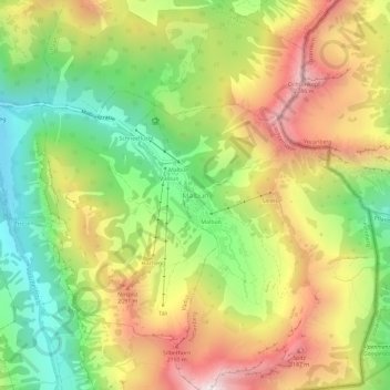
Name: Malbun topographic map, elevation, terrain.
Location: Malbun, Triesenberg, Oberland, Liechtenstein (47.08262 9.58831 47.12262 9.62831)
Average elevation: 1,782 m
Minimum elevation: 1,309 m
Maximum elevation: 2,329 m
Other topographic maps
Click on a map to view its topography, its elevation and its terrain.