
Pradonio topographic map
Interactive map
Click on the map to display elevation.
About this map
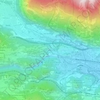
Name: Pradonio topographic map, elevation, terrain.
Location: Pradonio, Jaillons, Turin, Piémont, 10059, Italie (45.12206 7.01739 45.16206 7.05739)
Average elevation: 738 m
Minimum elevation: 481 m
Maximum elevation: 1,578 m
Other topographic maps
Click on a map to view its topography, its elevation and its terrain.