
Adrèt topographic map
Interactive map
Click on the map to display elevation.
About this map
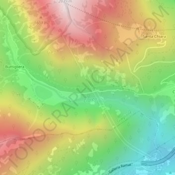
Name: Adrèt topographic map, elevation, terrain.
Location: Adrèt, Jaillons, Turin, Piémont, Italie (45.13015 6.96501 45.15015 6.98501)
Average elevation: 1,269 m
Minimum elevation: 647 m
Maximum elevation: 1,986 m
Other topographic maps
Click on a map to view its topography, its elevation and its terrain.