Geolocate

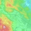
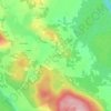
Grobnik topographic map

Click on the map to display elevation.

About this map

Name: Grobnik topographic map, elevation, terrain.

Location: Grobnik, Grad Slunj, Karlovac County, Croatia (45.22406 15.61170 45.24670 15.63825)

Average elevation: 234 m

Minimum elevation: 161 m

Maximum elevation: 326 m

Other topographic maps

Click on a map to view its topography, its elevation and its terrain.

Zvonarci

Croatia > Karlovac County > Šišljavić

Average elevation: 108 m

Saint Gera

Croatia > Karlovac County > Grad Ozalj

At the top of Sveta Gera, at an altitude of 1178 meters, there is a telecommunication tower and a military barracks whose location is strategically important to Croatia. The barracks were used by the Yugoslav People's Army (JNA) until early 1991 when its soldiers withdrew from the site following breakup of…

Average elevation: 961 m

Kula

Croatia > Karlovac County > Jasenak

Average elevation: 1,226 m

Ogulin

Croatia > Karlovac County

Average elevation: 391 m

Rosići

Croatia > Karlovac County > Sjeničak Lasinjski

Average elevation: 236 m

Kamanje

Croatia > Karlovac County

Average elevation: 208 m

Livade

Croatia > Karlovac County > Gornje Primišlje

Average elevation: 289 m

Ogulin

Croatia > Karlovac County

Average elevation: 391 m

Gornje Primišlje

Croatia > Karlovac County > Grad Slunj

Average elevation: 286 m

Ozalj

Croatia > Karlovac County

Average elevation: 179 m

Gornji Furjan

Croatia > Karlovac County > Grad Slunj

Average elevation: 325 m

Gear up for your next adventure:

🎒Replacement Sternum Straps - Repair parts for hiking rucksacks
💧Hydration Reservoirs - Convenient water bladders for hands-free drinking on the move
🧺Mesh Stuff Sacks - Breathable storage for wet gear or camp organization
🔦LED Camping Lanterns - Illumination for reading maps inside your tent at night
🕶️Polarized Sunglasses - Reduces glare from snow and water when reading terrain

As an Amazon Associate, this site earns from qualifying purchases at no extra cost to you.