
伊江村 topographic map
Interactive map
Click on the map to display elevation.
About this map
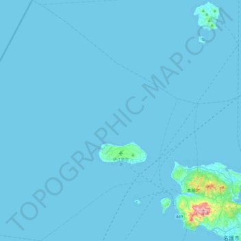
Name: 伊江村 topographic map, elevation, terrain.
Location: 伊江村, 国頭郡, Prefectura de Okinawa, 九州地方, Japón (26.58687 127.48576 26.95801 127.88467)
Average elevation: 8 m
Minimum elevation: 0 m
Maximum elevation: 429 m
Other topographic maps
Click on a map to view its topography, its elevation and its terrain.