
九州地方 topographic map
Interactive map
Click on the map to display elevation.
About this map
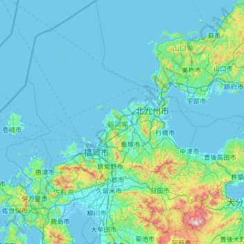
Name: 九州地方 topographic map, elevation, terrain.
Location: Prefectura de Fukuoka, 九州地方, Japón (32.93973 129.81331 34.64749 131.24950)
Average elevation: 118 m
Minimum elevation: -4 m
Maximum elevation: 1,753 m
Other topographic maps
Click on a map to view its topography, its elevation and its terrain.