
Barangka Drive topographic map
Interactive map
Click on the map to display elevation.
About this map
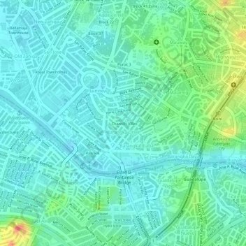
Name: Barangka Drive topographic map, elevation, terrain.
Average elevation: 17 m
Minimum elevation: 1 m
Maximum elevation: 59 m
Other topographic maps
Click on a map to view its topography, its elevation and its terrain.
Pasig River
Pasig River, District I, Mandaluyong, Eastern Manila District, Metro Manila, 1210, Philippines
Average elevation: 14 m
Mandaluyong
Mandaluyong, Metro Manila, 1551, Philippines
Average elevation: 33 m
New Zañiga
New Zañiga, Mandaluyong, Metro Manila, Philippines
Average elevation: 11 m