
瀧上町 topographic map
Interactive map
Click on the map to display elevation.
About this map
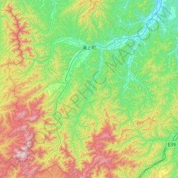
Name: 瀧上町 topographic map, elevation, terrain.
Location: 瀧上町, 紋別郡, 北海道, 日本 (43.91374 142.83799 44.29183 143.19789)
Average elevation: 481 m
Minimum elevation: 23 m
Maximum elevation: 1,523 m
Other topographic maps
Click on a map to view its topography, its elevation and its terrain.