
المشرفة topographic map
Interactive map
Click on the map to display elevation.
About this map
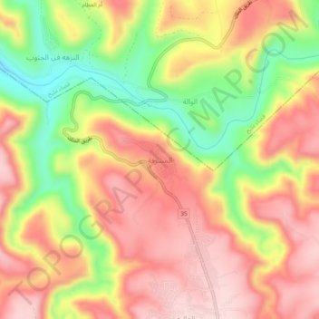
Name: المشرفة topographic map, elevation, terrain.
Location: المشرفة, Dieban Sub-District, Dieban District, Madaba, Jordan (31.52627 35.75664 31.56627 35.79664)
Average elevation: 582 m
Minimum elevation: 413 m
Maximum elevation: 705 m
Other topographic maps
Click on a map to view its topography, its elevation and its terrain.
منشية السواري
Jordan > Madaba > Dieban Sub-District
منشية السواري, Dieban Sub-District, Dieban District, Madaba, Jordan
Average elevation: 729 m