
Icogne topographic map
Interactive map
Click on the map to display elevation.
About this map
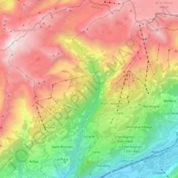
Name: Icogne topographic map, elevation, terrain.
Location: Icogne, Sierre, Vallés, 1977, Suiza (46.26187 7.42181 46.38526 7.49112)
Average elevation: 1,802 m
Minimum elevation: 502 m
Maximum elevation: 3,225 m
Other topographic maps
Click on a map to view its topography, its elevation and its terrain.