
Daillet topographic map
Interactive map
Click on the map to display elevation.
About this map
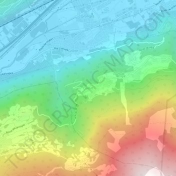
Name: Daillet topographic map, elevation, terrain.
Location: Daillet, Grône, Sierre, Valais, 3979, Suisse (46.22247 7.44322 46.26247 7.48322)
Average elevation: 1,036 m
Minimum elevation: 494 m
Maximum elevation: 2,187 m
Other topographic maps
Click on a map to view its topography, its elevation and its terrain.
Crans-Montana
Crans-Montana, Sierre, Valais, 3960, Suisse
Average elevation: 1,660 m
Saint-Clément
Suisse > Valais > Sierre > Vaas
Saint-Clément, Vaas, Lens, Sierre, Valais, 3960, Suisse
Average elevation: 767 m