
Govisumber topographic map
Interactive map
Click on the map to display elevation.
About this map
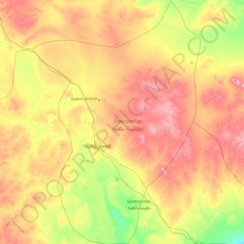
Name: Govisumber topographic map, elevation, terrain.
Location: Govisumber, Mongolia (45.93452 107.95679 46.98035 109.00391)
Average elevation: 1,309 m
Minimum elevation: 1,055 m
Maximum elevation: 1,720 m
Other topographic maps
Click on a map to view its topography, its elevation and its terrain.