
Serrekunda topographic map
Interactive map
Click on the map to display elevation.
About this map
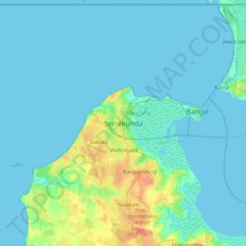
Name: Serrekunda topographic map, elevation, terrain.
Location: Serrekunda, Kanifing Municipal Council, The Gambia (13.27876 -16.83481 13.59876 -16.51481)
Average elevation: 5 m
Minimum elevation: -2 m
Maximum elevation: 35 m
Other topographic maps
Click on a map to view its topography, its elevation and its terrain.