Geolocate

Rock topographic map

Click on the map to display elevation.

About this map

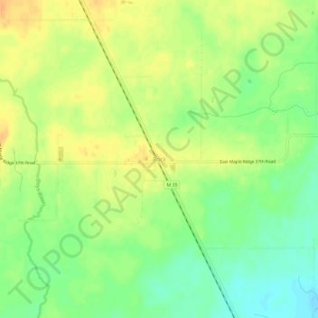
Name: Rock topographic map, elevation, terrain.

Location: Rock, Maple Ridge Township, Delta County, Michigan, 49880, United States (46.04884 -87.18597 46.08884 -87.14597)

Average elevation: 286 m

Minimum elevation: 268 m

Maximum elevation: 300 m

Other topographic maps

Click on a map to view its topography, its elevation and its terrain.

Escanaba

United States > Michigan > Delta County

Average elevation: 182 m

Escanaba

United States > Michigan > Delta County

Average elevation: 182 m

Ensign Township

United States > Michigan > Delta County

Average elevation: 198 m

Gladstone

United States > Michigan > Delta County

Average elevation: 188 m

Gear up for your next adventure:

🧭Professional Hiking Compasses - High-precision liquid-filled compasses for map reading and orientation
Camping Shelters - Emergency and lightweight shelters for outdoor use
🔋Solar Chargers - Eco-friendly charging solutions for outdoor use
Lightweight Solo Tents - Backpacking tents designed for wild camping in the UK highlands
🎒Hiking Child Carriers - Explore the outdoors with the whole family safely

As an Amazon Associate, this site earns from qualifying purchases at no extra cost to you.