
Bougtob topographic map
Interactive map
Click on the map to display elevation.
About this map
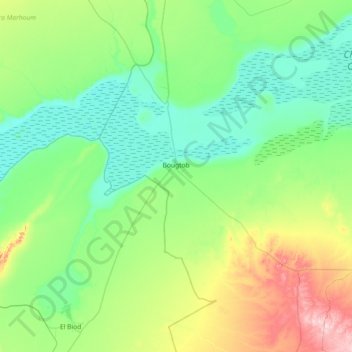
Name: Bougtob topographic map, elevation, terrain.
Location: Bougtob, Bougtob District, El Bayadh, 32010, Algeria (33.71996 0.02196 34.32113 0.59337)
Average elevation: 1,052 m
Minimum elevation: 975 m
Maximum elevation: 1,323 m
Other topographic maps
Click on a map to view its topography, its elevation and its terrain.
Tousmouline
Algeria > El Bayadh > Bougtob District
Tousmouline, Bougtob District, El Bayadh, Algeria
Average elevation: 1,211 m