
Horw topographic map
Interactive map
Click on the map to display elevation.
About this map
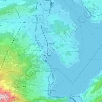
Name: Horw topographic map, elevation, terrain.
Location: Horw, Luzern, Schweiz (46.98901 8.25813 47.03694 8.36850)
Average elevation: 612 m
Minimum elevation: 428 m
Maximum elevation: 2,063 m
Other topographic maps
Click on a map to view its topography, its elevation and its terrain.
Kastanienbaum
Kastanienbaum, Horw, Luzern, 6047, Schweiz
Average elevation: 457 m