
Kalishte topographic map
Click on the map to display elevation.
About this map
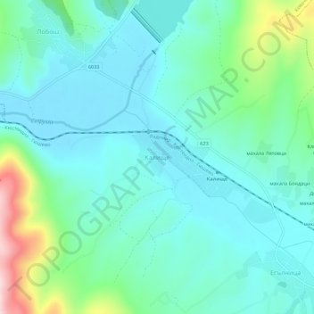
Name: Kalishte topographic map, elevation, terrain.
Location: Kalishte, Kovachevtsi, Pernik, Bulgaria (42.46876 22.81243 42.50876 22.85243)
Average elevation: 661 m
Minimum elevation: 595 m
Maximum elevation: 907 m
Other topographic maps
Click on a map to view its topography, its elevation and its terrain.