Geolocate

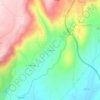
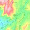
Castanheira topographic map

Click on the map to display elevation.

About this map

Name: Castanheira topographic map, elevation, terrain.

Location: Castanheira, Trancoso, Guarda, Portugal (40.82118 -7.39078 40.85946 -7.33849)

Average elevation: 819 m

Minimum elevation: 692 m

Maximum elevation: 980 m

Other topographic maps

Click on a map to view its topography, its elevation and its terrain.
Vila Franca das Naves

Portugal > Guarda > Trancoso

Average elevation: 598 m

Freches

Portugal > Guarda > Trancoso

Average elevation: 588 m

Corças

Portugal > Guarda > Trancoso

Average elevation: 825 m

Castaíde

Portugal > Guarda > Trancoso

Average elevation: 807 m

Ribeira do Freixo

Portugal > Guarda > Trancoso

Average elevation: 629 m

Esporões

Portugal > Guarda > Trancoso > Moreira de Rei

Average elevation: 723 m

Golfar

Portugal > Guarda > Trancoso > Moreira de Rei

Average elevation: 762 m

Gear up for your next adventure:

🥾Walking Shoes - Lightweight walking shoes for countryside and coastal paths
🔦Head Torches - Hands-free lighting for hiking and camping
🌄Outdoor Binoculars - Compact binoculars for landscape observation
📦Compression Sacks - Reduce backpack volume efficiently
👟Heavy Duty Boot Laces - Always carry a spare for your hiking footwear

As an Amazon Associate, this site earns from qualifying purchases at no extra cost to you.