Geolocate

Talipan topographic map

Click on the map to display elevation.

About this map

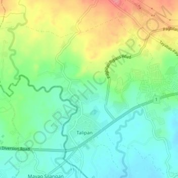
Name: Talipan topographic map, elevation, terrain.

Location: Talipan, Pagbilao, Quezon, Calabarzon, 4302, Philippines (13.95729 121.63295 13.98455 121.66774)

Average elevation: 56 m

Minimum elevation: 25 m

Maximum elevation: 107 m

Other topographic maps

Click on a map to view its topography, its elevation and its terrain.

Pagbilao

Philippines > Quezon > Pagbilao

Average elevation: 45 m

Gear up for your next adventure:

🧵Survival Paracord - Multi-purpose cordage for emergency repairs and shelters
🧊Insulated Flasks - Keeps drinks hot or cold during hikes
🗺️Ordnance Survey Maps - Official UK maps for walking and outdoor activities
👕Technical Hiking Tees - Moisture-management for high-exertion climbs
🦶Anti-Blister Balms - Protect your feet before long topographic expeditions

As an Amazon Associate, this site earns from qualifying purchases at no extra cost to you.