Geolocate

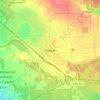
Prohres topographic map

Click on the map to display elevation.

About this map

Name: Prohres topographic map, elevation, terrain.

Location: Prohres, Hrodivka settlement hromada, Pokrovskii Raion, Donetsk Oblast, 85351, Ukraine (48.23877 37.48893 48.25009 37.50367)

Average elevation: 210 m

Minimum elevation: 178 m

Maximum elevation: 229 m

Other topographic maps

Click on a map to view its topography, its elevation and its terrain.

Zolotyi Kolodiaz

Ukraine > Donetsk Oblast

Average elevation: 142 m

Lyman

Ukraine > Donetsk Oblast > Lyman

Average elevation: 106 m

Kramatorsk

Ukraine > Donetsk Oblast > Kramatorsk

Average elevation: 141 m

Sloviansk

Ukraine > Donetsk Oblast > Sloviansk

Average elevation: 131 m

Bakhmut

Ukraine > Donetsk Oblast > Bakhmut

Average elevation: 138 m

Soledar

Ukraine > Donetsk Oblast > Soledar

Average elevation: 118 m

Avdiivka

Ukraine > Donetsk Oblast > Avdiivka

Average elevation: 210 m

Oleksandrivka

Ukraine > Donetsk Oblast > Oleksandrivka

Average elevation: 137 m

Siversk

Ukraine > Donetsk Oblast > Siversk

Average elevation: 103 m

Victoria

Ukraine > Donetsk Oblast

Average elevation: 181 m

Victoria

Ukraine > Donetsk Oblast

Average elevation: 181 m

Nevelske

Ukraine > Donetsk Oblast

Average elevation: 192 m

Bakhmutka

Ukraine > Donetsk Oblast > Bakhmut

Average elevation: 108 m

Olenivka

Ukraine > Donetsk Oblast

Average elevation: 212 m

New York

Ukraine > Donetsk Oblast > New York

Average elevation: 157 m

Gear up for your next adventure:

🕶️Glacier Goggles - Maximum protection for high-altitude snow topography
🧰Survival Kits - Emergency tools for remote environments
📻Hand-Crank Emergency Radios - Stay updated on weather warnings in remote areas
🗺️Topographic Maps - Detailed maps showing elevation and terrain features
🪢Paracord - Multi-purpose cord for camping and survival

As an Amazon Associate, this site earns from qualifying purchases at no extra cost to you.