
Gatwe topographic map
Interactive map
Click on the map to display elevation.
About this map
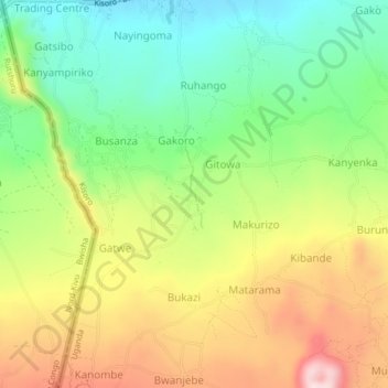
Name: Gatwe topographic map, elevation, terrain.
Location: Gatwe, Kisoro, Western Region, Uganda (-1.33424 29.59821 -1.29424 29.63821)
Average elevation: 2,033 m
Minimum elevation: 1,871 m
Maximum elevation: 2,247 m
Other topographic maps
Click on a map to view its topography, its elevation and its terrain.