Geolocate

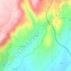
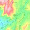
Vilares topographic map

Click on the map to display elevation.

About this map

Name: Vilares topographic map, elevation, terrain.

Location: Vilares, Trancoso, Guarda, Portugal (40.69545 -7.31117 40.74578 -7.25579)

Average elevation: 571 m

Minimum elevation: 435 m

Maximum elevation: 808 m

Other topographic maps

Click on a map to view its topography, its elevation and its terrain.
Vila Franca das Naves

Portugal > Guarda > Trancoso

Average elevation: 598 m

Freches

Portugal > Guarda > Trancoso

Average elevation: 588 m

Corças

Portugal > Guarda > Trancoso

Average elevation: 825 m

Castaíde

Portugal > Guarda > Trancoso

Average elevation: 807 m

Ribeira do Freixo

Portugal > Guarda > Trancoso

Average elevation: 629 m

Esporões

Portugal > Guarda > Trancoso > Moreira de Rei

Average elevation: 723 m

Golfar

Portugal > Guarda > Trancoso > Moreira de Rei

Average elevation: 762 m

Gear up for your next adventure:

🎒Backpack Rain Covers - Universal waterproof covers to protect your gear from downpours
🔥Emergency Fire Starters - Reliable ignition tools for survival situations in damp conditions
💧Hydration Reservoirs - Convenient water bladders for hands-free drinking on the move
🧴Sport Sunscreen Sticks - High-protection sunblock that won't run into your eyes on the trail
🧥Softshell Jackets - Breathable jackets for active outdoor use

As an Amazon Associate, this site earns from qualifying purchases at no extra cost to you.