
Heinerscheid topographic map
Interactive map
Click on the map to display elevation.
About this map
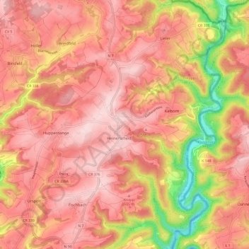
Name: Heinerscheid topographic map, elevation, terrain.
Location: Heinerscheid, Clervaux, Canton Clervaux, Luxemburg (50.06036 6.02584 50.13657 6.13796)
Average elevation: 458 m
Minimum elevation: 283 m
Maximum elevation: 540 m
Other topographic maps
Click on a map to view its topography, its elevation and its terrain.
Kalborn
Luxemburg > Canton Clervaux > Clervaux
Kalborn, Clervaux, Canton Clervaux, 9757, Luxemburg
Average elevation: 447 m