
Florida topographic map
Interactive map
Click on the map to display elevation.
About this map
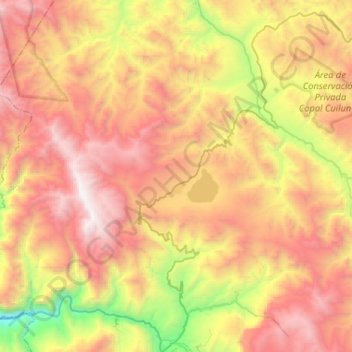
Name: Florida topographic map, elevation, terrain.
Location: Florida, Bongará, Amazonas, Peru (-5.89039 -78.10229 -5.74026 -77.84234)
Average elevation: 2,265 m
Minimum elevation: 873 m
Maximum elevation: 3,545 m
Other topographic maps
Click on a map to view its topography, its elevation and its terrain.
San Cristóbal
Peru > Amazonas > San Cristóbal
San Cristóbal, Luya, Amazonas, Peru
Average elevation: 2,283 m
Pedro Ruiz Gallo
Pedro Ruiz Gallo, Jazán, Bongará, Amazonas, 01130, Peru
Average elevation: 1,598 m