Geolocate

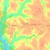
Templeman topographic map

Click on the map to display elevation.

About this map

Name: Templeman topographic map, elevation, terrain.

Location: Templeman, Westmoreland County, Virginia, United States (38.05069 -76.79495 38.09069 -76.75495)

Average elevation: 37 m

Minimum elevation: 7 m

Maximum elevation: 50 m

Other topographic maps

Click on a map to view its topography, its elevation and its terrain.

Montross

United States > Virginia > Westmoreland County

Average elevation: 37 m

Gear up for your next adventure:

🔥Reusable Hand Warmers - Maintain dexterity in your fingers for precise map handling
🧊Personal Water Filters - Drink safely from mountain streams marked on your map
🧰Survival Kits - Emergency tools for remote environments
❄️Walking Crampons - Added traction for icy slopes and winter peak bagging
🔦Outdoor Torches - Reliable torches for night navigation

As an Amazon Associate, this site earns from qualifying purchases at no extra cost to you.