Geolocate

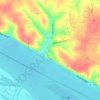
Lockhaven topographic map

Click on the map to display elevation.

About this map

Name: Lockhaven topographic map, elevation, terrain.

Location: Lockhaven, Jersey County, Illinois, 63302, United States (38.92064 -90.30815 38.96064 -90.26815)

Average elevation: 142 m

Minimum elevation: 126 m

Maximum elevation: 208 m

Other topographic maps

Click on a map to view its topography, its elevation and its terrain.
Jerseyville

United States > Illinois > Jersey County

Average elevation: 188 m

Grafton

United States > Illinois > Jersey County

Average elevation: 186 m

Jerseyville

United States > Illinois > Jersey County

Average elevation: 188 m

Grafton

United States > Illinois > Jersey County

Average elevation: 186 m

Elsah

United States > Illinois > Jersey County

Average elevation: 160 m

Grafton

United States > Illinois > Jersey County

Average elevation: 186 m

Gear up for your next adventure:

🧣Neck Gaiters - Protects against wind and sun on exposed ridges and peaks
🥾Hiking Boot Waterproofing Wax - Maintain the lifespan of your leather trekking boots
🛑Emergency Bivvy Bags - Heat-reflective survival bags for unexpected nights out
🧴Sport Sunscreen Sticks - High-protection sunblock that won't run into your eyes on the trail
🧰First Aid Kits - Essential safety kits for outdoor activities

As an Amazon Associate, this site earns from qualifying purchases at no extra cost to you.