
Huicheng District topographic map
Interactive map
Click on the map to display elevation.
About this map
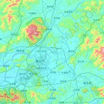
Name: Huicheng District topographic map, elevation, terrain.
Location: Huicheng District, Huizhou, Guangdong Province, China (22.91717 114.11896 23.41620 114.78859)
Average elevation: 118 m
Minimum elevation: -4 m
Maximum elevation: 1,054 m
Other topographic maps
Click on a map to view its topography, its elevation and its terrain.
Huiyang District
China > Guangdong Province > Huizhou
Huiyang District, Huizhou, Guangdong Province, China
Average elevation: 69 m
Huizhou
China > Guangdong Province > Huizhou
Huizhou, Guangdong Province, China
Average elevation: 134 m