Geolocate

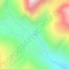
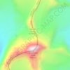
Salang topographic map

Click on the map to display elevation.

About this map

Name: Salang topographic map, elevation, terrain.

Location: Salang, Bhatwari, Uttarkashi District, Uttarakhand, India (30.82213 78.61557 30.86213 78.65557)

Average elevation: 2,172 m

Minimum elevation: 1,579 m

Maximum elevation: 3,283 m

Other topographic maps

Click on a map to view its topography, its elevation and its terrain.
Harsil

India > Uttarakhand > Bhatwari

Average elevation: 2,761 m

Kyarkoti Lake

India > Uttarakhand > Bhatwari

Average elevation: 4,043 m

Pari Maatri Taal

India > Uttarakhand > Bhatwari

Average elevation: 4,443 m

Kedar Tal

India > Uttarakhand > Bhatwari

Average elevation: 4,814 m

Pulam Sumda

India > Uttarakhand > Bhatwari

Average elevation: 4,571 m

Gangotri Glacier

India > Uttarakhand > Bhatwari

Average elevation: 5,259 m

Dayara Bugyal

India > Uttarakhand > Bhatwari

Average elevation: 3,451 m

Gangotri Glacier

India > Uttarakhand > Bhatwari

Average elevation: 5,259 m

Kedar Tal

India > Uttarakhand > Bhatwari

Average elevation: 4,814 m

Kalindi Khal Area

India > Uttarakhand > Bhatwari

Average elevation: 5,857 m

Harsil

India > Uttarakhand > Bhatwari

Average elevation: 2,761 m

Gear up for your next adventure:

⌚Altimeter Watches - Watches measuring altitude for mountain activities
👖Hiking Trousers - Durable trousers designed for rough terrain
📢Survival Whistles - Essential safety gear for signaling for help in mountain fog
🥾Hiking Boot Waterproofing Wax - Maintain the lifespan of your leather trekking boots
🛰️Outdoor GPS Navigation - Navigation devices for remote and off-grid areas

As an Amazon Associate, this site earns from qualifying purchases at no extra cost to you.