
Beydiğin topographic map
Interactive map
Click on the map to display elevation.
About this map
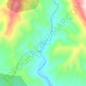
Name: Beydiğin topographic map, elevation, terrain.
Location: Beydiğin, Manavgat, Antalya, Mediterranean Region, Turkey (36.96344 31.35407 37.00344 31.39407)
Average elevation: 298 m
Minimum elevation: 135 m
Maximum elevation: 619 m
Other topographic maps
Click on a map to view its topography, its elevation and its terrain.