
Riehen topographic map
Interactive map
Click on the map to display elevation.
About this map
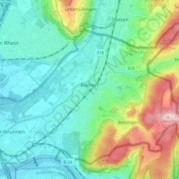
Name: Riehen topographic map, elevation, terrain.
Location: Riehen, Basel-City, 4125, Switzerland (47.55993 7.62079 47.60091 7.69379)
Average elevation: 325 m
Minimum elevation: 250 m
Maximum elevation: 520 m
Other topographic maps
Click on a map to view its topography, its elevation and its terrain.
Vorstädte
Switzerland > Basel-City > Basel
Vorstädte, Basel, Basel-City, Switzerland
Average elevation: 271 m