
Thank you for supporting this site ❤️
Make a donation
Make a donation
Gear up for your next adventure:
As an Amazon Associate, this site earns from qualifying purchases at no extra cost to you.
Tajur topographic map
Click on the map to display elevation.
Thank you for supporting this site ❤️
Make a donation
Make a donation
Gear up for your next adventure:
As an Amazon Associate, this site earns from qualifying purchases at no extra cost to you.
About this map
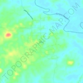
Name: Tajur topographic map, elevation, terrain.
Location: Tajur, Paser, East Kalimantan, Kalimantan, Indonesia (-1.65080 116.18062 -1.61080 116.22062)
Average elevation: 13 m
Minimum elevation: 0 m
Maximum elevation: 50 m
Thank you for supporting this site ❤️
Make a donation
Make a donation
Gear up for your next adventure:
As an Amazon Associate, this site earns from qualifying purchases at no extra cost to you.