
Río Santiago topographic map
Interactive map
Click on the map to display elevation.
About this map
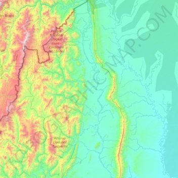
Name: Río Santiago topographic map, elevation, terrain.
Location: Río Santiago, Amazonas, Perú (-4.43790 -78.21966 -2.99809 -77.63982)
Average elevation: 561 m
Minimum elevation: 133 m
Maximum elevation: 2,935 m
Other topographic maps
Click on a map to view its topography, its elevation and its terrain.
Mariscal Benavides
Mariscal Benavides, Rodríguez de Mendoza, Amazonas, Perú
Average elevation: 2,423 m