
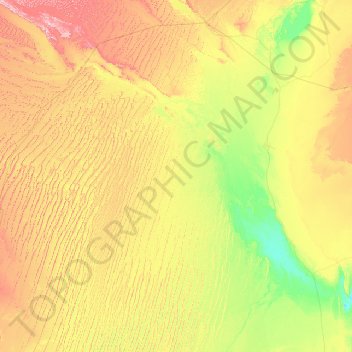
Fenoughil topographic map
Interactive map
Click on the map to display elevation.
About this map
Name: Fenoughil topographic map, elevation, terrain.
Location: Fenoughil, Fenoughil District, Adrar, 00100, Algeria (27.45316 -2.98301 27.76152 0.59437)
Average elevation: 300 m
Minimum elevation: 120 m
Maximum elevation: 579 m
The villages in Fenoughil commune, from Tasfaout in the north to Bour Sidi Youssef in the south, are all built around the northern and eastern side of oases at an elevation of about 220 metres (720 ft). These oases form part of a long longer string of oases known as the Tuat region, running from north to south through Adrar Province. Beyond the oases, the sandy Erg Chech desert lies to the west and the rocky Tademaït plateau lies to the east.
Other topographic maps
Click on a map to view its topography, its elevation and its terrain.
Tamantit
Algeria > Adrar > Fenoughil District > Tamantit
Tamantit, Fenoughil District, Adrar, 1038, Algeria
Average elevation: 270 m