
Gwa Township topographic map
Interactive map
Click on the map to display elevation.
About this map
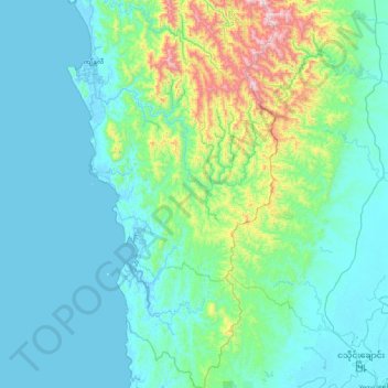
Name: Gwa Township topographic map, elevation, terrain.
Location: Gwa Township, Thandwe District, Rakhine, 07182, Myanmar (17.33613 94.42932 18.13960 94.88717)
Average elevation: 160 m
Minimum elevation: -3 m
Maximum elevation: 1,191 m
Other topographic maps
Click on a map to view its topography, its elevation and its terrain.