Geolocate

Kwaba topographic map

Interactive map

Click on the map to display elevation.

About this map

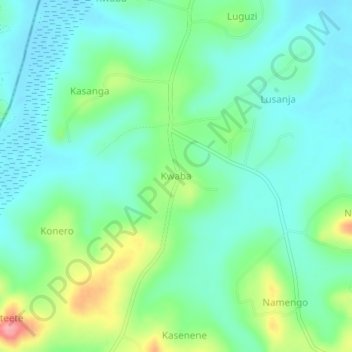
Name: Kwaba topographic map, elevation, terrain.

Location: Kwaba, Mukono, Central Region, Uganda (0.50973 32.67072 0.54973 32.71072)

Average elevation: 1,118 m

Minimum elevation: 1,088 m

Maximum elevation: 1,197 m

Other topographic maps

Click on a map to view its topography, its elevation and its terrain.

Mayangayanga

Uganda > Mukono

Mayangayanga, Mukono, Central Region, Uganda

Average elevation: 1,126 m

Namakwa

Uganda > Mukono

Namakwa, Mukono, Central Region, Uganda

Average elevation: 1,169 m

Buwujja-mbeya

Uganda > Mukono > Buwujja-mbeya

Buwujja-mbeya, Mukono, Central Region, Uganda

Average elevation: 1,149 m

Kalagi

Uganda > Mukono > Kalagi

Kalagi, Mukono, Central Region, Uganda

Average elevation: 1,147 m

Lugala

Uganda > Mukono > Lugala

Lugala, Mukono, Central Region, Uganda

Average elevation: 1,080 m