Geolocate

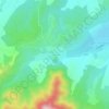
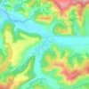
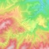
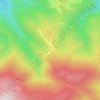
Cristian topographic map

Click on the map to display elevation.

About this map

Name: Cristian topographic map, elevation, terrain.

Location: Cristian, Sibiu, 557085, Romania (45.60109 23.84022 45.81220 24.07809)

Average elevation: 806 m

Minimum elevation: 404 m

Maximum elevation: 1,954 m

Other topographic maps

Click on a map to view its topography, its elevation and its terrain.

Mârșa

Romania > Sibiu > Avrig

Average elevation: 400 m

Cascada Bâlea

Romania > Sibiu > Cârțișoara

Average elevation: 1,704 m

Nucet

Romania > Sibiu

Average elevation: 474 m

Colun

Romania > Sibiu

Average elevation: 426 m

Cisnădioara

Romania > Sibiu > Cisnădie

Average elevation: 585 m

Porumbacu de Sus

Romania > Sibiu

Average elevation: 474 m

Bâlea Lake

Romania > Sibiu > Cârțișoara

Bâlea Lake (Romanian: Lacul Bâlea or Bâlea Lac, pronounced [ˈbɨle̯a]; Hungarian: Bilea-tó) is a glacier lake situated at 2,034 m of altitude in the Făgăraș Mountains, in central Romania, in Cârțișoara, Sibiu County. There are two chalets opened all the year round, a meteorological station and a…

Average elevation: 2,080 m
Paltinis

Romania > Sibiu > Sibiu > Păltiniș

Average elevation: 1,419 m

Mălâncrav

Romania > Sibiu

Average elevation: 515 m

Buia

Romania > Sibiu

Average elevation: 437 m

Porumbacu de Sus

Romania > Sibiu

Average elevation: 474 m

Veștem

Romania > Sibiu

Average elevation: 426 m

Lazaret

Romania > Sibiu

Average elevation: 600 m

Hosman

Romania > Sibiu

Average elevation: 455 m

Sibiel

Romania > Sibiu > Săliște

Average elevation: 649 m

Rod

Romania > Sibiu

Average elevation: 794 m

Hosman

Romania > Sibiu

Average elevation: 455 m

Alma Vii

Romania > Sibiu

Average elevation: 506 m

Metiș

Romania > Sibiu

Average elevation: 499 m

Pelișor

Romania > Sibiu

Average elevation: 533 m

Păltiniș

Romania > Sibiu > Sibiu

It is situated at 1440 m altitude, being the highest resort in Romania. It lies in a conifer forest. It is a popular winter destination and in summer it is sought for its peacefulness, fresh air and easily accessible trekking routes.

Average elevation: 1,405 m

Gear up for your next adventure:

⌚GPS Outdoor Watches - Watches with GPS tracking for hiking and exploration
🎒Hiking Daypacks - Compact backpacks ideal for short hikes and excursions
🥤Collapsible Water Bottles - Save space in your rucksack as you consume your water
🧭Professional Hiking Compasses - High-precision liquid-filled compasses for map reading and orientation
🧥Softshell Jackets - Breathable jackets for active outdoor use

As an Amazon Associate, this site earns from qualifying purchases at no extra cost to you.