
BJELASICA topographic map
Interactive map
Click on the map to display elevation.
About this map
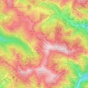
Name: BJELASICA topographic map, elevation, terrain.
Location: BJELASICA, Berane Municipality, Montenegro (42.85257 19.64211 42.88780 19.73318)
Average elevation: 1,744 m
Minimum elevation: 1,209 m
Maximum elevation: 2,115 m
Other topographic maps
Click on a map to view its topography, its elevation and its terrain.