
Pfäffikon ZH topographic map
Interactive map
Click on the map to display elevation.
About this map
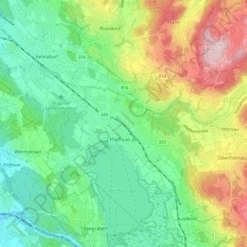
Name: Pfäffikon ZH topographic map, elevation, terrain.
Location: Pfäffikon ZH, Bezirk Pfäffikon, Zürich, Schweiz (47.33714 8.75144 47.40219 8.84167)
Average elevation: 600 m
Minimum elevation: 481 m
Maximum elevation: 825 m
Other topographic maps
Click on a map to view its topography, its elevation and its terrain.
Tagelswangen
Schweiz > Zürich > Bezirk Pfäffikon
Tagelswangen, Lindau, Bezirk Pfäffikon, Zürich, 8317, Schweiz
Average elevation: 513 m
Sternenberg
Schweiz > Zürich > Bezirk Pfäffikon
Sternenberg, Bauma, Bezirk Pfäffikon, Zürich, 8499, Schweiz
Average elevation: 797 m
Bauma
Schweiz > Zürich > Bezirk Pfäffikon
Bauma, Bezirk Pfäffikon, Zürich, Schweiz
Average elevation: 756 m