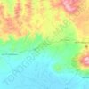
Mojo topographic map
Click on the map to display elevation.
Mojo
Mojo (Oromo: Moojoo, Amharic: ሞጆ) is a town in central Ethiopia, named after the nearby Modjo River. Located in the East Shewa Zone of the Oromia Region, it has a latitude and longitude of 8°39′N 39°5′E / 8.650°N 39.083°E / 8.650; 39.083 with an elevation between 1788 and 1825 meters above sea level. It is the administrative center of Lome district.
About this map
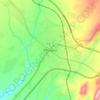
Name: Mojo topographic map, elevation, terrain.
Location: Mojo, East Shewa, Oromia Region, Ethiopia (8.54699 39.08500 8.62699 39.16500)
Average elevation: 1,800 m
Minimum elevation: 1,681 m
Maximum elevation: 1,986 m
Other topographic maps
Click on a map to view its topography, its elevation and its terrain.
Bale Mountains National Park
The Bale Mountains play a vital role in climate control of the region by attracting large amounts of orographic rainfall, which has obvious implications for livestock and agricultural production. Some 600–1,000 mm (24–39 in) fall annually in the lower altitude areas, while 1,000–1,400 mm (39–55 in)…
Average elevation: 2,612 m
Lake Langano
Lake Langano (Oromo: Hora Langaanoo, Amharic: ላንጋኖ ሐይቅ) is a lake in the Oromia Region of Ethiopia, exactly 200 kilometers by road south of the capital, Addis Ababa, on the border between the East Shewa Zone and Arsi Zones. It is located to the east of Lake Abijatta in the Main Ethiopian Rift at…
Average elevation: 1,625 m