
Laceby topographic map
Interactive map
Click on the map to display elevation.
About this map
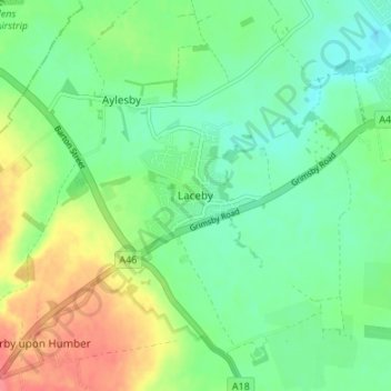
Name: Laceby topographic map, elevation, terrain.
Average elevation: 24 m
Minimum elevation: 1 m
Maximum elevation: 64 m
North East Lincolnshire trails, hiking, mountain biking, running and outdoor activities
Other topographic maps
Click on a map to view its topography, its elevation and its terrain.
New Waltham
United Kingdom > England > North East Lincolnshire > Humberston Grange
Average elevation: 13 m